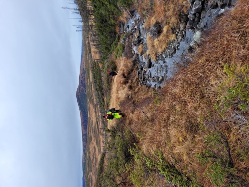
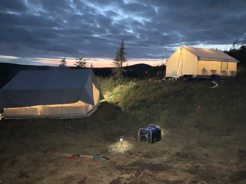
The 100%-owned Gregory River provides a unique opportunity to explore for critical and precious minerals in a highly prospective part of Newfoundland that has been largely overlooked over the past several decades and today remains underexplored. The property is centered on an 11-km stretch of the Gregory River volcanogenic massive sulphide (“VMS”) target corridor that hosts several copper ± gold-zinc-silver VMS prospects, as well as a cluster of high-grade copper + gold veins. Several campaigns of early-stage exploration by Golden Spike have significantly enhanced the potential of the property and built the framework for new discoveries.
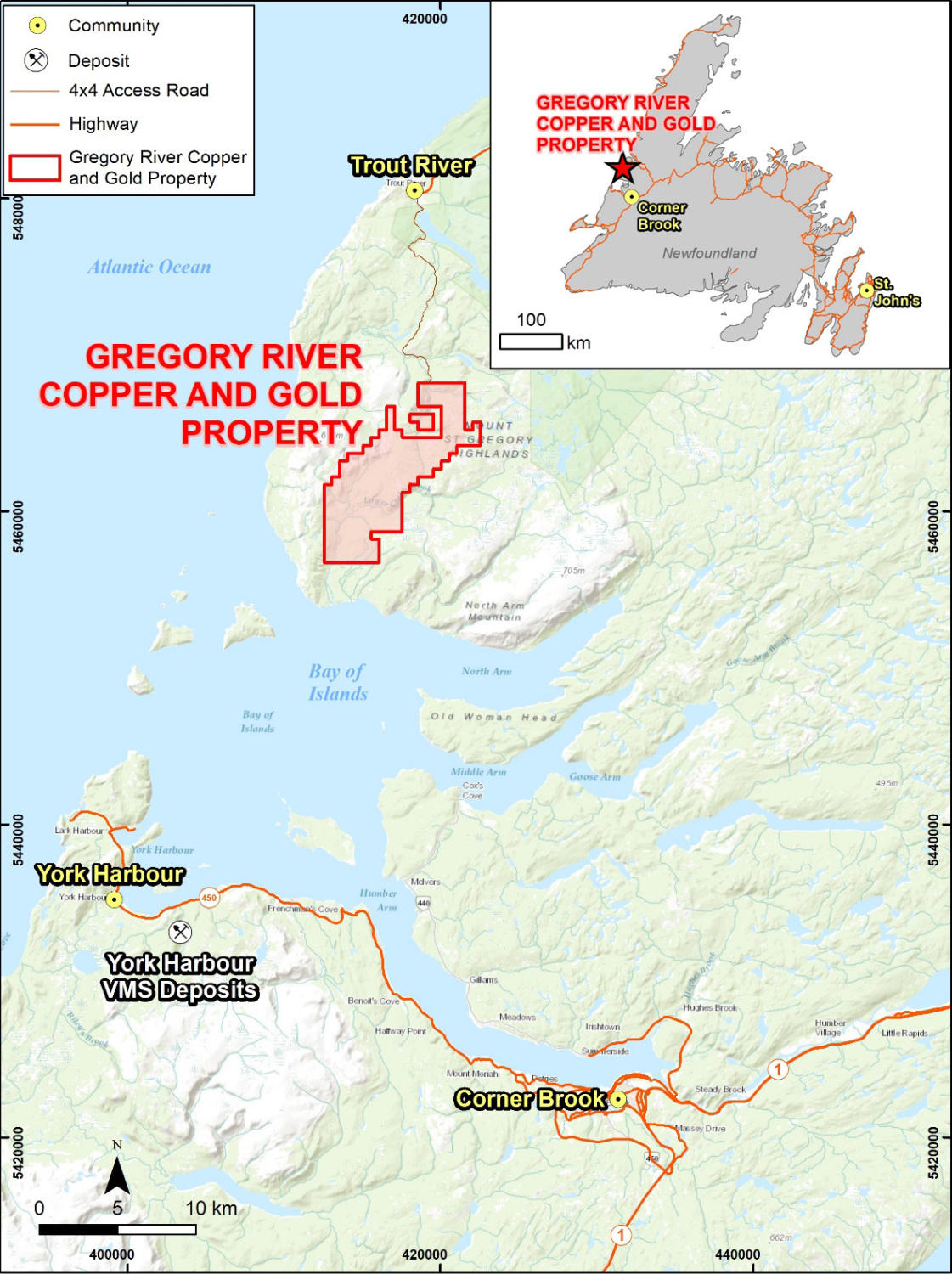
The Gregory River VMS Target Corridor represents an approximately 11-kilometre-long, underexplored trend characterized by Cyprus-type VMS targets, with eight historical drill holes reaching target depth. Cyprus-type VMS deposits in Canada typically average more than 3% copper and around 2.5 g/t gold. Within the corridor, multiple VMS targets have been identified, including Lode 9, Steep Brook, Camp Brook/Moose Brook, Gregory River, Jumbo South, and Deep Brook. Historical and recent surface sampling has returned high-grade results averaging approximately 1.75% copper and 0.76 g/t gold, with assays reaching up to 19.6% copper and 27.4 g/t gold. During the 2024 exploration program, induced polarization (IP) surveys and diamond drilling were completed at Steep Brook and Lode 9, resulting in the discovery of new mineralized zones. In 2025, Winkie drilling led to the discovery of new copper mineralization at Lode 9 Northeast.
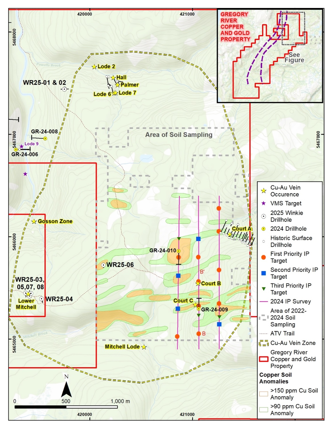
The Vein Zone consists of a cluster of high-grade copper ± gold veins located in the northeast corner of the property. The area remains underexplored, with all known veins open in all directions and only limited historical drilling completed to date. Historical and recent surface sampling has returned high-grade results averaging around 2% to 5% copper, but often in excess of 10% copper, along with anomalous gold averaging around 0.1 g/t to 0.5 g/t gold, but occasionally reaching up to 3.5 g/t gold. Between 2022 and 2024, soil surveying outlined several northwest- to southwest-trending, multi-element anomalies (Cu ± Zn, Au, Co, As) extending up to 1,500 metres in length, most of which occur over areas lacking outcrop or prior exploration. The 2024 exploration program included an IP survey that defined multiple high-priority anomalies, followed by two drill holes—one at Court C and one testing a new IP anomaly. In 2025, Winkie drilling led to the discovery of a wide gold-copper-zinc breccia–stockwork zone at Lower Mitchell.
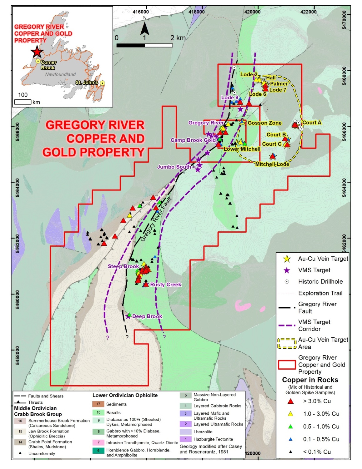
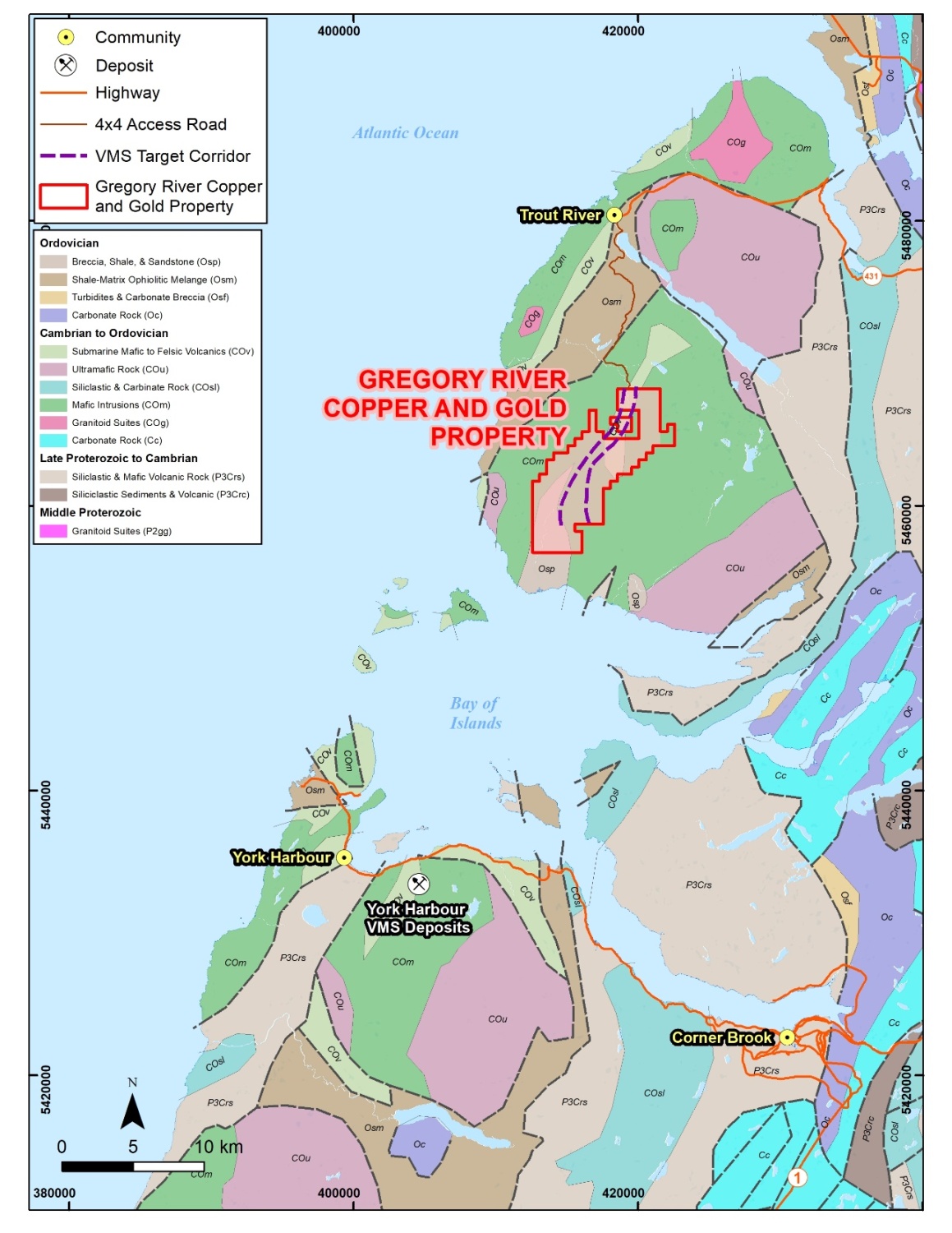
The property is situated within the Lower Ordovician Bay of Islands Ophiolite Complex and is underlain by a north-northeast–trending sequence of ultramafic to mafic intrusive rocks, basaltic lavas, and narrow sedimentary zones. This same ophiolitic complex also hosts the York Harbour VMS deposit, located 27 kilometres to the south.* A broad, regional north-northeast–trending, gently plunging synform is interpreted to extend through the southern part of the property, accompanied by local anticlinal fold pairs and potentially continuing further north. The north-northeast–trending Gregory River Fault transects the western portion of the property, accompanied by numerous fault splays and localized zones of shearing and brecciation. Many of the VMS and lode-style prospects on the property appear to be spatially associated with these structures. The VMS-style prospects at Gregory River are interpreted to be Cyprus-type deposits, primarily hosted within basaltic units near the contact with gabbro.
*Mineralization at York Harbour is hosted on an adjacent property and is not necessarily indicative of mineralization hosted on the Company’s Property.
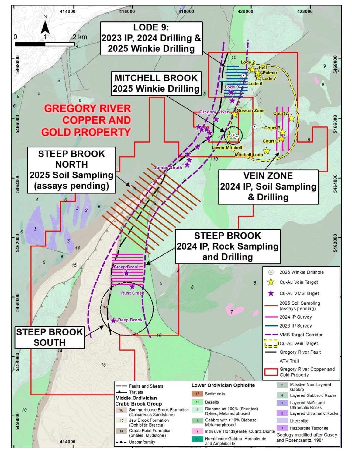
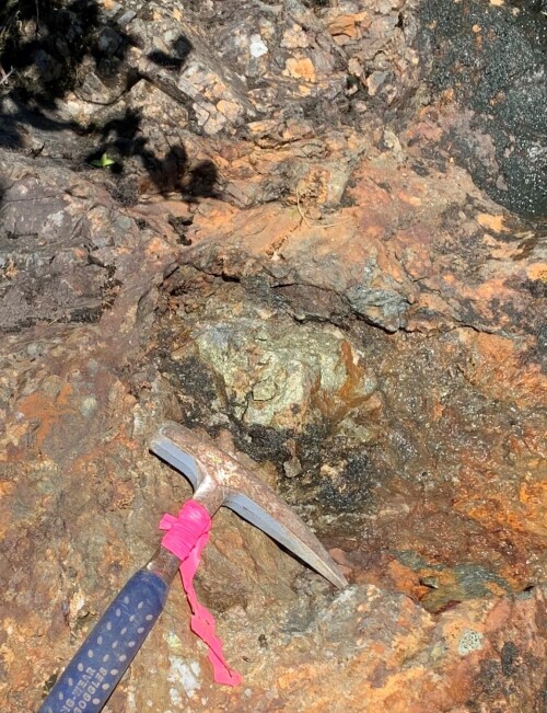
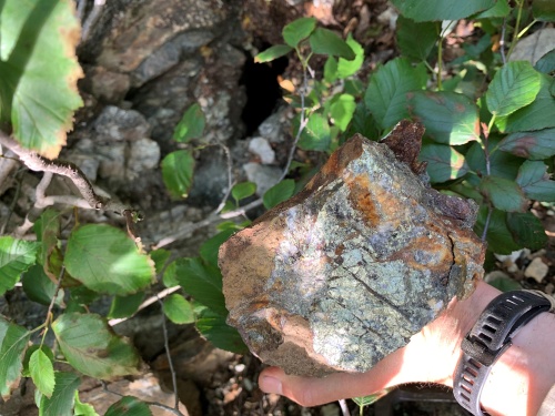
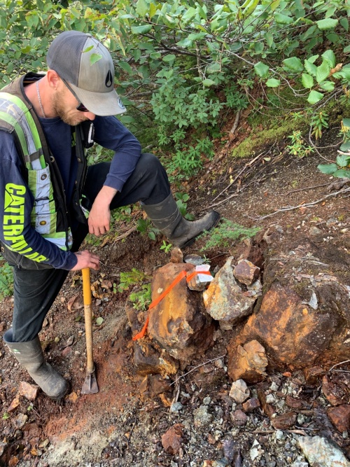
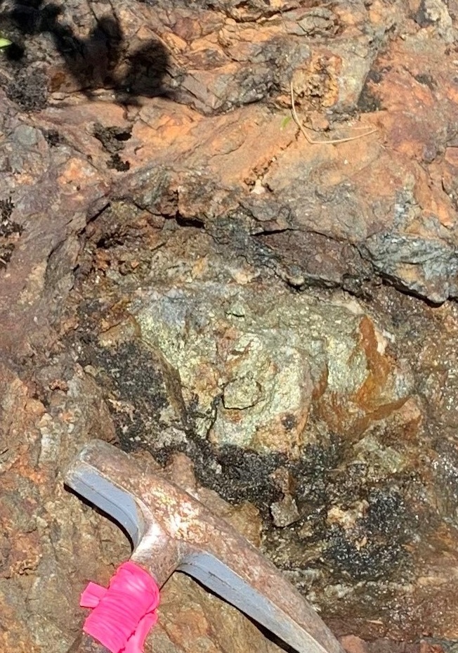
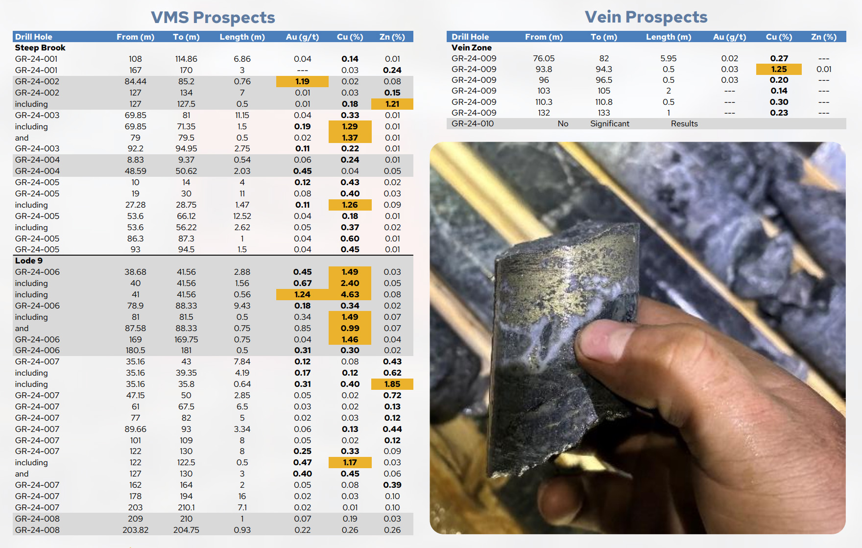
Multiple VMS prospects have been identified along the Gregory River VMS Corridor. These prospects are hosted within basalt near its contact with gabbro and are spatially associated with the Gregory River Fault. Mineralization is both stratabound and fracture- or veinlet-hosted, consisting of disseminated to massive pyrite, chalcopyrite ± bornite, chalcocite, covellite, and sphalerite. The main VMS targets include Steep Brook, Lode 9, Gregory River, Moose Brook/Camp Brook*, Jumbo South, and Rusty Brook. Historical drilling was limited, with eight of eleven holes successfully reaching target depth and returning several significant intercepts, though no follow-up was conducted at the time. In 2024, Golden Spike initiated reconnaissance drilling at Lode 9 (three holes totaling 654 metres) and Steep Brook (five holes totaling 921 metres), intersecting multiple anomalous intervals. In 2025, Winkie drilling led to the discovery of new copper mineralization at Lode 9 Northeast.
*The Camp Brook/Moose Brook prospect straddles the west boundary of one of the licences on the Property and portions of the mineralization may occur on an adjacent property. Insufficient drilling has been done to estimate the true widths of the drilled intervals. None of the historical core from Lode 9 and Camp Brook/Moose Brook has been kept and the QP is unable to validate these historical drill results. However, recent surface sampling corresponds with the general grades reported from these earlier drilling campaigns and the QP feels that it is reasonable to report these results as historical, as they provide a useful guide for future exploration. A portion of Steep Brook hole CC-2 was re-sampled by the Company returning copper values in a similar range.
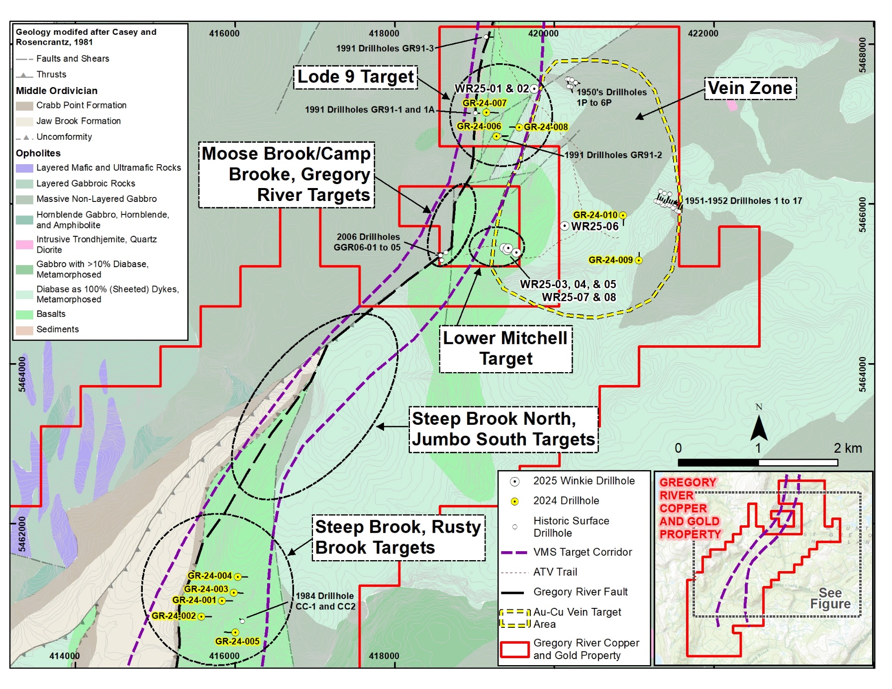
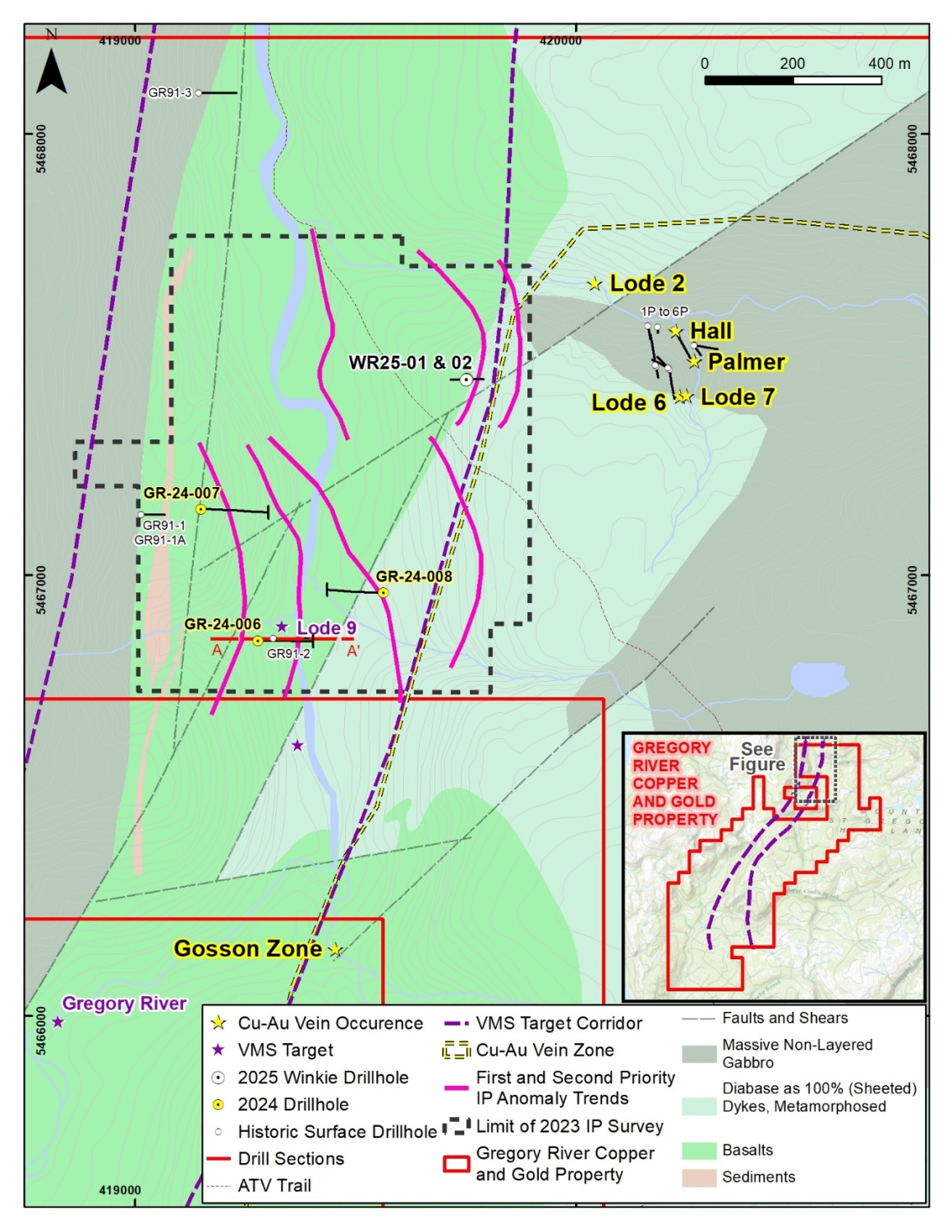
Golden Spike completed an IP Survey (2023), revealing several subparallel anomaly trends, one coinciding with the Lode 9 Prospect. Follow-on exploration included three diamond drill holes:
2025 Winkie Drilling (2 holes) at Lode 9 Northeast intersected:
Historical core from Lode 9 has not been kept and the QP is unable to validate this historical drill hole and the historical sampling. However, the companies that completed the historical work were large, reputable companies that would have had sampling and quality control processes in place that were considered industry standard for the time. Insufficient drilling has been completed to determine true width of the mineralization intersected in the drill hole.
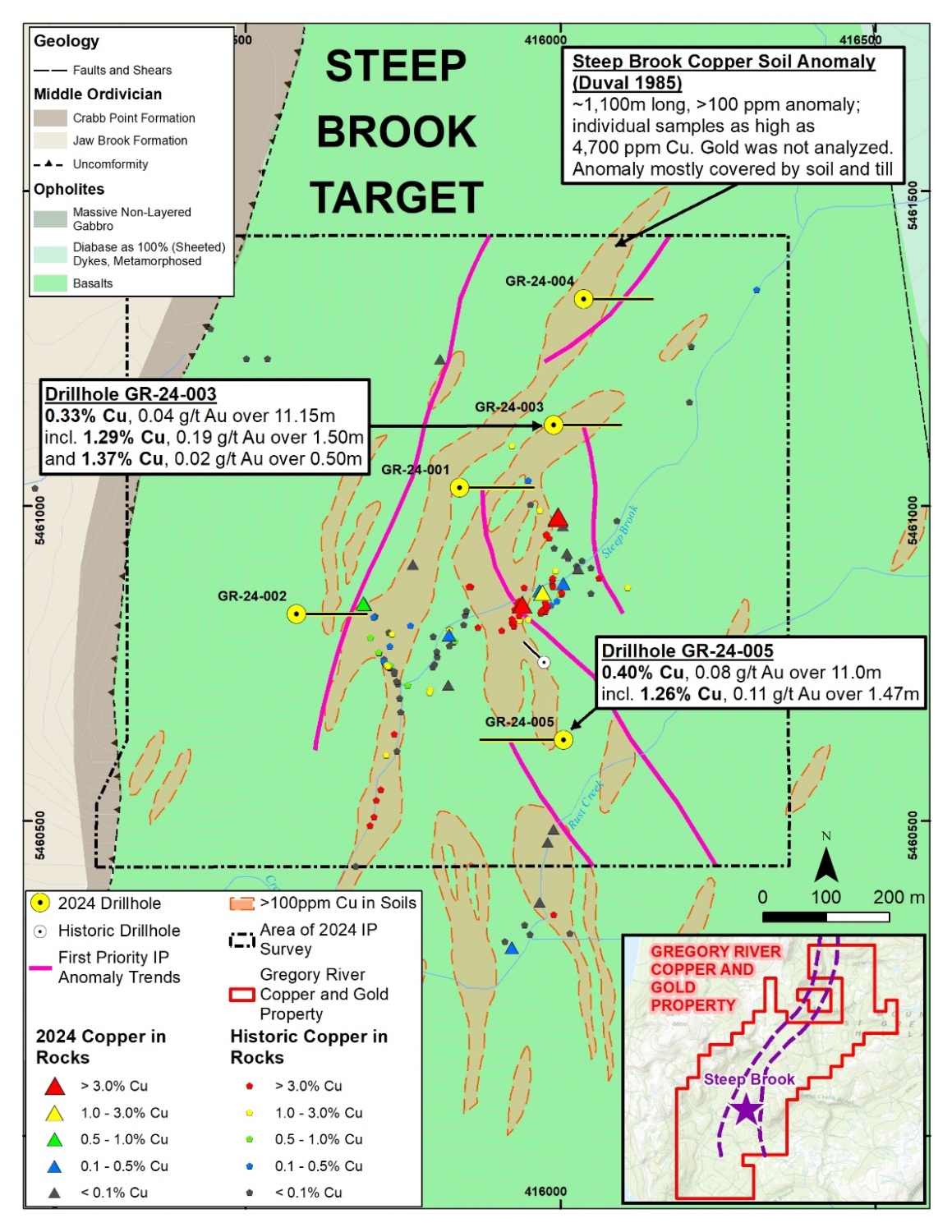
Golden Spike completed an IP Survey (2023), revealing several anomaly trends coinciding with historical soil and rock sampling anomalies. Five reconnaissance drill holes completed during 2024 totaling 921 m tested five different IP anomalies supported by geological interpretations, soil results and rock sampling. Each drill hole returned anomalous results, highlighted by:
Drilling confirms Golden Spike’s VMS target concept and that wide zones (>10 m drilled width) with higher grade intervals (>1.0% Cu) exist at Steep Brook. Next steps will be to interpret the layers of data to vector into areas where mineralization could be wider and higher in grade.
Vein Zone
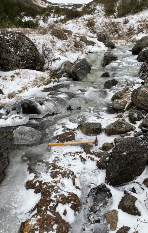
The area hosts a cluster of east-trending, high-grade quartz-carbonate-sulphide veins. These veins typically range from approximately 0.5 m to 2 m in width, locally expanding up to 5 m to 6 m, and contain fracture-hosted and semi-massive to massive sulphides with copper content ranging from about 1% to 25%, averaging roughly 2% to 6%. Historical sampling did not consistently test for gold or other metals, but recent surface sampling indicates potential gold values between 0.1 g/t and 3 g/t. The Court A vein was historically tested by 17 shallow core holes drilled in the 1950s, tracing the vein approximately 340 m northwest, down to vertical depths of around 50 m, with veins remaining open in all directions. Historical drillhole sampling was limited to only the highest-grade portions of the veins (two or three assays per hole), leaving much of the surrounding host rock unsampled. Potential exists for wider mineralized haloes surrounding the main veins and for discovering new veins hidden below surface soil and till cover. To test this concept, Golden Spike completed soil sampling, rock sampling, IP, and two diamond drill holes. Selected historical down-hole intercepts at Court A include (note: gold was not analysed):
Golden Spike soil sampling revealed several ENE-trending copper anomalies greater than 90 ppm (up to 1,080 ppm), extending up to 1,500 m in length and 50 to 150 m in width. These anomalies coincide with the Court A, B, and C Prospects and continue for considerable distances across soil-covered areas that have no previously documented exploration. Three wide-spaced, north-south IP lines completed in 2024 identified numerous first and second priority IP anomalies, several of which align with soil anomalies and known Prospects. Drill hole DDH GR-24-009 tested the Court C IP anomaly and intersected approximately 40 meters of chlorite-altered gabbro containing 1-15% disseminated and fracture or veinlet-hosted pyrite ± chalcopyrite, coincident with the IP chargeability high. Within this alteration, a roughly 5.95 m interval assayed 0.27% copper (76.05-82.0 m), and further downhole, a 0.5 m section returned 1.25% copper (93.8-94.3 m). Drill hole DDH GR-24-010 had no significant results, but may have been collared too far south.
Looking Forward
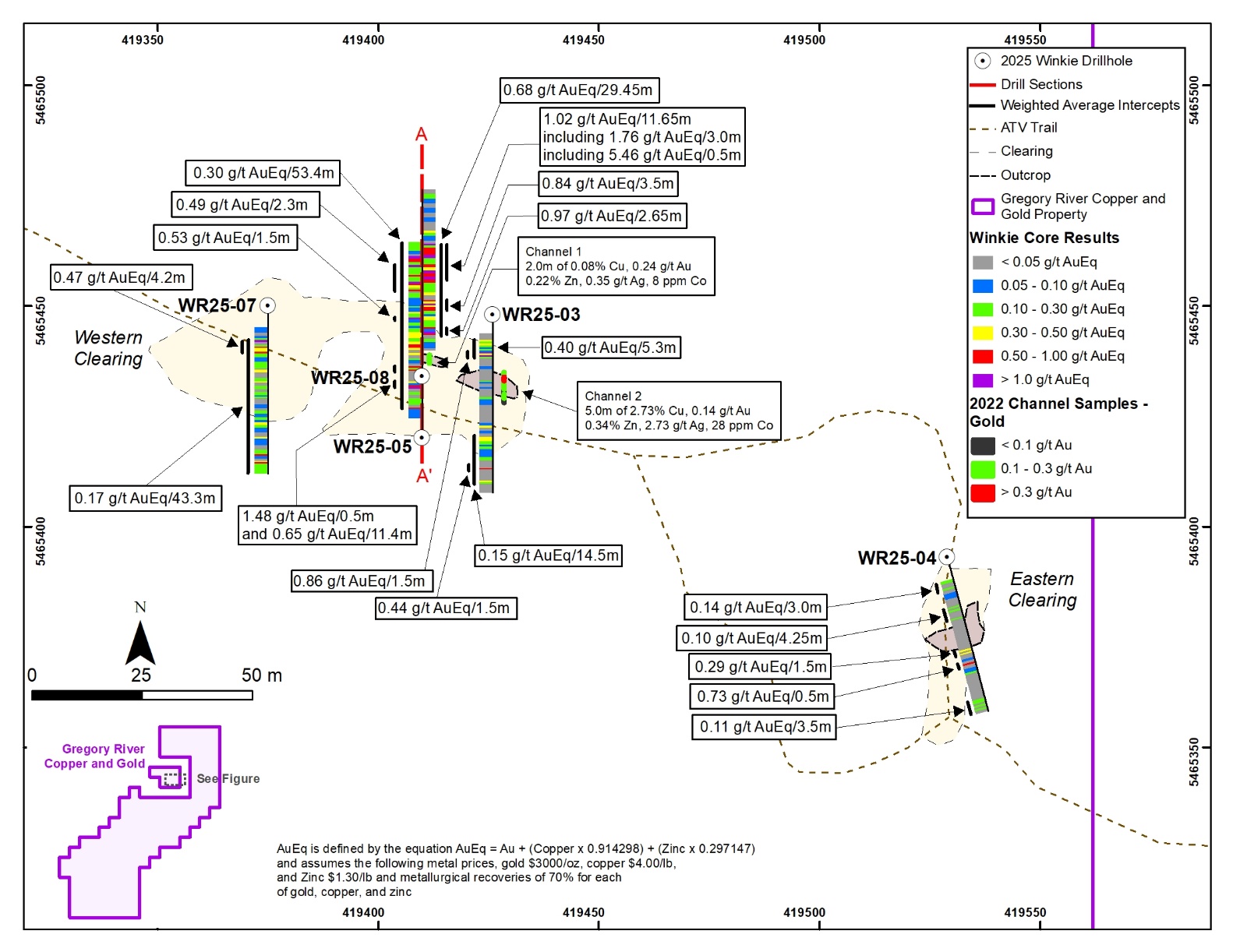
Shallow Winkie core drilling at Lower Mitchell uncovered a 40–50 metre wide, east- to east-northeast–trending breccia–stockwork zone of gold-copper-zinc mineralization, considerably broader than the 2–5 metre widths indicated by previous surface work. The zone is hosted within brecciated basalt exhibiting chlorite–carbonate alteration and areas of strong silicification. Mineralization occurs in multiple quartz–carbonate–sulphide veins and breccia infill containing pyrite, chalcopyrite, sphalerite, and arsenopyrite. A broad, lower-grade mineralized envelope encloses several higher-grade zones, including:
Mineralization is open in all directions and additional, deeper drilling is being planned.
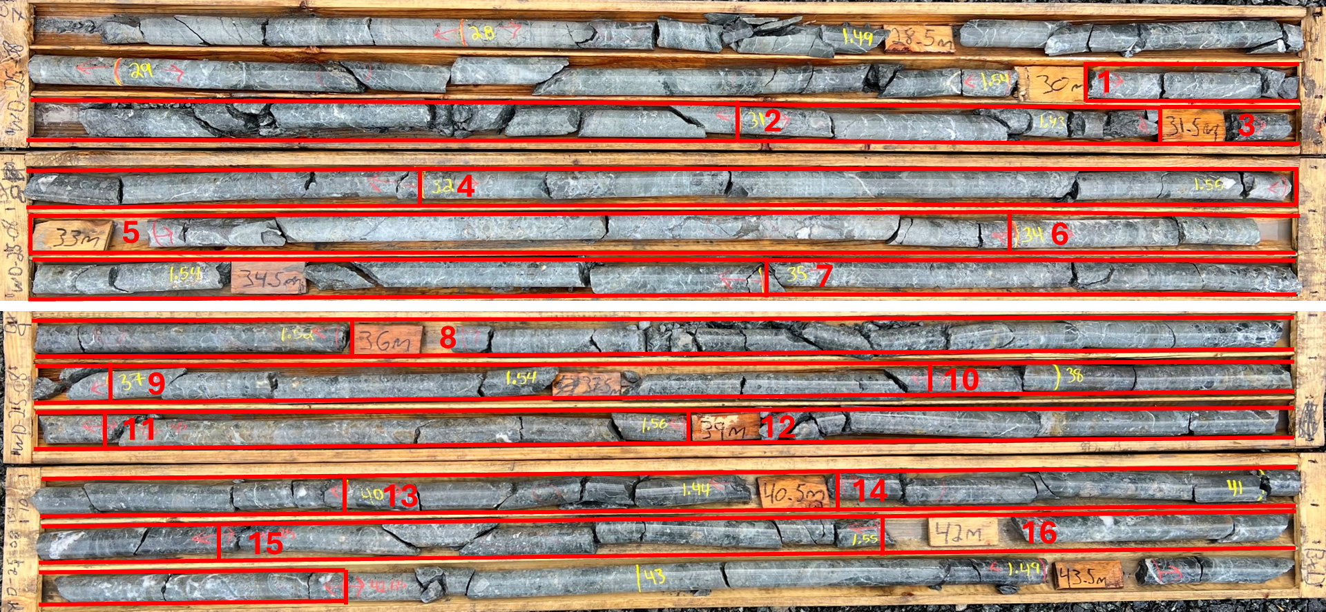
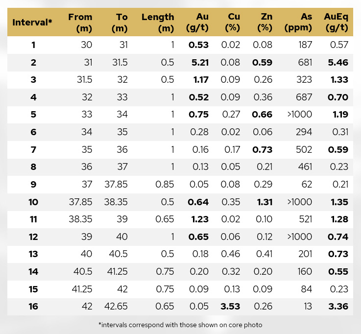
Drill Hole WD25-08:
Complete Drill Results:
Wide-spaced, reconnaissance drilling results support Golden Spike’s exploration concept for VMS mineralization at Gregory River. Drilling in the Vein Zone has demonstrated the potential for wider zones of copper mineralization. Numerous high-priority IP anomalies remain untested at both the VMS and Vein Zone targets. The next steps involve the integration and technical analysis of drill results, combined with surface geochemistry, field mapping, and geophysics, to develop vectors towards wider and higher-grade mineralization, identify new exploration targets, and ultimately conduct additional drilling.
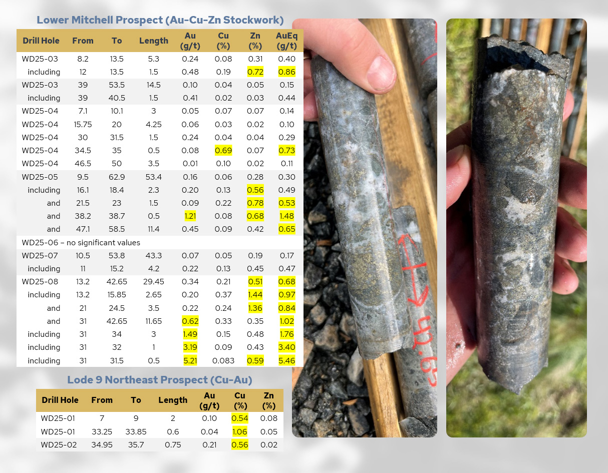
First-pass Winkie drilling tested several near-surface, ATV-accessible targets, returning significant results from seven of the eight holes completed. Drilling at Lower Mitchell intersected multiple gold, copper, and zinc zones across much wider intervals than previously indicated by surface work. A new zone of copper mineralization was also discovered at Lode 9 Northeast, located approximately 750 metres from the Lode 9 prospect. The true dimensions and potential grades of these early-stage prospects remain to be determined through additional drilling.